So You Wanna Be A Volcanologist…

In August I received an email from an undergrad at a US university. They obtained my contact info through this blog post and asked some really good questions about how to set themselves up to become a volcanologist through their geology course work. With their permission & all identifying information removed, I’ve copied and pasted their questions and my answers in my reply below:

“Stoked to hear from [someone] interested in studying volcanoes! And very happy that you found the blog post we all contributed to useful and encouraging enough to reach out to us – that is exactly what we hoped would happen. 😊 I will answer your q’s as best as I can.

Firstly, [redacted] is an excellent college for geology. I went to grad school at the University of Hawai’i at Manoa to get my Master’s degree – and one of my best friends there had gone to [requestor’s university] for his undergrad! At UVA (where I went for my undergrad), they didn’t offer much beyond Geology 101, except for a few specialized courses. I ended up with an Environmental Science major and Chemistry minor, and then I had to go back to school part time later on to pick up other important geo classes. So your [requestor’s university] geology degree will set you up well to study volcanology in an advanced degree – no worries there.

Question 1: what classes are essential to volcanology?

In terms of geology classes, any/all of those classes you listed [Mineralogy, Structural Geology, Geomorphology, Petrology, Paleoclimatology, Paleontology, Hydrology, and Geochemistry] could help, depending on what you decide to focus on in volcanology. Volcanology spans a wide range of disciplines: paleoclimate and paleontology would help a lot if you end up studying tephrochronology (i.e. ash layers in drill cores) like my friend and colleague Jenni Hopkins; geochemistry, mineralogy, and petrology are essential for researching magma chemistry like I am; structural geo is necessary for any physical volcanology and geophysical research on volcanoes; and geomorphology and hydrology are useful for studying landscapes in general. However, I would suggest mineralogy, petrology, and structural geo as a minimum to set you up well for admittance into a M.S. and/or PhD program in volcanology, or a career in some facet of geology. If other classes beyond those strike you as interesting (like geochem), definitely take them.

If you have the means and capability, I would highly suggest going to a geology field camp with some or many volcanology components, e.g. https://geologyfieldcamp.sdsmt.edu/IcelandVolcanologyCamp.htm, perhaps between your junior and senior years of college, after you’ve taken mineralogy, petrology, and structure. You’ll likely be able to get credits toward your degree, and it will give you a taste of volcanology and what you like/don’t like about it, to help shape your future research questions.

A list of geo field camps can be found here: https://geology.com/field-camp.shtml

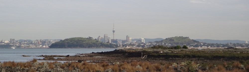
One of my colleagues, volcanologist Darren Gravley, runs the Frontiers Abroad experience, which combines field camp with a Earth Science-focused study abroad semester in NZ: https://frontiersabroad.com/geology-of-new-zealand. They incorporate volcanology in their field camp (many US-based field camps don’t), and you’d get to go to New Zealand and explore our volcanoes!

This page has some grants listed to help with funding for field camp: https://www.whitman.edu/academics/majors-and-minors/geology/field-camp

If you don’t have the means or ability to go to a volcanology field camp, there are a few basic volcanology online courses out there – they probably won’t count towards your degree, but you will be able to find out more about the discipline at least:

https://www.open.edu/openlearn/science-maths-technology/geology/volcanic-hazards/content-section-0?active-tab=description-tab

https://www.edx.org/search?q=volcano

https://www.centreofexcellence.com/shop/volcanology-diploma-course/

Other than the geology courses you’ve listed for your major and field camp/online classes, I would secondly highly recommend taking some of these electives:

  • a GIS course,
  • a basic Intro to statistics course,
  • learning a computer programming language,
  • advanced math, physics, and chemistry classes (esp if you think you might end up doing geophysics or igneous geochemistry),
  • You’ll set yourself apart if you have some training in Writing and Communication, too.


The GIS – or mapping on computer software — skills will be helpful no matter what you end up doing in geology. A basic understanding of statistics and significant differences in data is oft-overlooked but super important when interpreting your data. I have found that knowing how to code to analyse my data is becoming more and more necessary and useful (MATLAB, Python, and R are all very popular). And the more math, physics, and chem you have, the better of you’ll be in any science career!

Another big recommendation I have is to practice good concise writing, building an argument, reading comprehension, and communicating to various audiences – so, classes with a lot of writing or presentation requirements (esp in the humanities) will serve you well when it comes time to write up your thesis or data for publication. Science is no good if you can’t convey a message or build an argument around what the data are telling you, so you can convince other people that your interpretation is the right one 😊

After you graduate, you’ll never regret taking the time to take the hard courses while still in college – it is much, much harder to go BACK to take classes after you realize you need those skills!

Question 2: what do volcanologists typically do and how hard is it to get a job in that field? What kinds of jobs are there?

Well, unfortunately volcanology is kinda tough to get a job in (esp if you expect to actually go out in the field with the volcanoes), mostly due to the lack of $$$ and positions available, but everyone who has done so all has one thing in common: we studied volcanology in a Master’s or PhD programme first. I don’t know anyone that stopped at undergrad. With some hard work in a grad program, good networking skills, and luck, you should be able to find a job in volcanology.

In terms of what we do, it varies. I coordinate a volcanology research programme for my job, and I describe my work here: https://rockheadsciences.com/research-assistant-volcanic-hazards-elaine-smid/

Most volcanologists either work as professors in academia or for the government (like the USGS) – these positions pretty much all require PhDs and are very competitive. Some other folks end up in the commercial realm (e.g. in the mining industry looking for kimberlite diamonds or gold veins formed from volcanic fluids, or looking for hot rock to turn into energy as geothermal geologists), and some become land use planners or emergency managers or manage social media (comms) during eruptions! Check out the other entries in that initial blog post you found me on ( & also explore the Rock Head Science ‘Day in the Life of’ blog series (linked in the above paragraph)– there are tons of us out there, and we seemingly all do different things as volcanologists!!

My best advice here is to network, network, network, get as good of a thesis grade and GPA as you can, and put yourself out there for opportunities to gain experience, even if you don’t think you’re qualified! You never know…

Question 3: Lastly, what undergrad research do you think there is to do for volcanology-related topics? I know senior research is far down the road for me, but I’m just not sure what I could do volcanology-related, or if there’s research in a similar area that would complement it.

It’s difficult to answer this question without knowing what your options are at [requestor’s university]. I assume you’d need a thesis advisor there, and I am not sure what topics your faculty specialize in or what the timelines/budget are for data collection for your senior thesis. Definitely ask your geo profs what they would suggest for this – they will know much better than I will what is available to you and reasonable within the time-frame allotted!

Or maybe you will get a lead on a good research topic during field camp? I know that the Frontiers Abroad programme requires a research project and thesis.

In terms of complementary topics, any high pressure/temperature geochemical studies of rocks would be pretty complementary for igneous geochem and petrology, esp if it requires you to use a binocular microscope, doing some rock sampling and sample prep (rock saw, rock crushing, sieving, grinding, polishing, thin section and analytical mount prep, mineral picking), petrographic analysis, and analyzing samples on geochemical analytical equipment (e.g. XRF, EMPA, LA ICP MS…). Other than that, anything that gets you in the field or lab and getting experience in those settings is good for volcanology.

Looking through the [requestor’s university] list of senior thesis topics (I only looked through 2018 – 2021), all of the following would be volcanology or volcanology-related & would show future grad advisors that you are suited for a research topic in volcanology. [names and thesis titles redacted, but included topics such as ‘Mineralogy & Geochemistry of a Pluton,’ ‘Structural geometry of mafic bodies,’ ‘Tephra deposition within a lake core,’ ‘Petrogenesis of a pluton,’ ‘Structure, Petrology, and geochronology of dikes,’ ‘U/Pb zircon analyses,’ ‘Ages and origins of an ultramafic complex’]

In the end, it all really depends on what you are interested in! A good thesis topic is one you love and will keep you motivated even when things get challenging.”

And there you have it! My best advice for a budding volcanologist in their early college years. Please let me know if you find this useful or have follow up questions – my contact details can be found here.

Everything You Need to Visit Every Auckland Volcano: New Downloadable PDF!

The AVF downloadable is here! Great cover artwork by DEVORA research assistant Thomas Stolberger. Click on the link in the text below to download your own checklist.

Over the years, the goal of visiting all the volcanoes in Auckland has become quite popular. Many folks have put this goal on their bucket list or even started blogs about it. One of the main difficulties with this goal is knowing where to go to check a certain volcano off the list. Many of our volcanoes have been quarried away, paved over, repurposed, or just plain do not look like the volcanoes they are anymore. It all gave me an idea–what if I compiled a bare-bones information and address checklist for people to use?

For a little while now, I’ve been pulling together a bunch of resources. With the pandemic and my PhD work keeping me very busy, I recruited DEVORA research assistant Thomas Stolberger to help finish off the document. He also added some nice artistic flair to it!

So, here it is, folks: a downloadable PDF checklist that provides an address, short blurb about each volcano, and some links useful for exploring each site:

Click here to download the Auckland Volcanoes Checklist!

The best way I have found to use it is to save it to my online drive (One Drive or Google Drive are great) and access it using my smartphone. I then check the volcanoes off and save the document as I go along. You can also just print off a hard copy and keep it somewhere handy for your volcano adventures.

Here is an example of an entry, with the icons and features pointed out:

We use Quick Reference icons to provide links to resources and offer up more information about the volcanoes.

If I had unlimited time and expertise, I would make an app and record free walking tours for the major volcanoes like you get at a museum, but that just isn’t possible at the moment. I will put this idea on my own bucket list…!

If you find any errors or have suggestions on how to improve this document, please get in touch using my University of Auckland email address (address found under “Contact Details’ in the right hand column).

How many volcanoes have YOU visited? How many Auckland volcanoes have you been to?

Maungawhau/Mt Eden’s Eruption Age Confirmed!

This text was written by Elaine R Smid a, in collaboration with Dr Bruce W Hayward b, Thomas Stolberger c, and Ewart Barnsley d

a PhD candidate & DEtermining VOlcanic Risk in Auckland (DEVORA) Research Assistant, University of Auckland

b Author, Retired geologist from University of Auckland and Geomarine Research

c DEVORA Research Assistant, University of Auckland

d Media Manager, City Rail Link


In some recent news articles, Maungawhau/Mt Eden volcano was confirmed to be 28,000 years old. This is the story of how that came about.

Maungawhau HAYWARD CREDIT 2018 (7)

Maungawhau and Auckland City. Image credit: Bruce W Hayward. Used with permission.

In February 2019, the City Rail Link (CRL) micro-tunnel boring machine “Jeffie” became entangled in a large tree as it was digging a tunnel to move the stormwater line out of the way of the new underground rail tunnels. Jeffie was dubbed “a little legend” for her excellent digging work.

2020.04 Jeffie-arriving-on-site-Mt-Eden-web CREDIT City Rail Link

City Rail Link’s micro-tunnel boring machine “Jeffie” encountered a tree that was used to find the age of Maungawhau’s eruption. Photo by City Rail Link.

The tree was found at a depth of about 15 m, approximately 50 m north of the rail line between Mt Eden Rd and Shaddock St in Eden Terrace, Auckland. The tree was a very large obstruction for the tunneler–over 1 m in diameter, so large that it steered the drilling off course. See below for the approximate location of the tree, viewed from the surface.

fig 1 tree location _ edited

The CRL tree was found at 15 m depth, approximately 50 m north of the rail line between Mt Eden Rd. and Shaddock St. in Eden Terrace, Auckland. Image from Google Earth Pro. Location data from CRL.

Before the tunneling started, CRL dug some vertical boreholes along the surface trace of the tunnel so that they knew what to expect while Jeffie was digging horizontally. This showed that the tree was found 1 – 1.5 m below lava flows from Maungawhau, as extrapolated from the boreholes (see below). This key piece of information–the tree’s location beneath lava flows–allows us to get a date for Maungawhau’s eruption. Whatever the age of the tree, the eruption followed soon after.

Fig 2a

Fig 2b

a) Cross-section excerpt of the area where the tree was found by CRL (blue star); b) Legend for stratigraphy shown in cross-section. Cross-section and legend courtesy of CRL.

CRL pulled the tree fragments to the surface (see below). Select samples of tree fragments were chosen by DEtermining VOlcanic Risk in Auckland (DEVORA) researchers for radiocarbon analysis during a visit to CRL offices in April 2019. The tree fragments are well-preserved, with light charring or carbonisation evident on parts of some fragments.

fig 3

a) Tree in mud or tuff, entangled in the City Rail Link micro-tunnel boring machine near Maungawhau; b & c) Fragments of tree brought to the surface; d) Tree fragments sampled for radiocarbon dating. Fragments are well-preserved and/or carbonised in some spots. Photos a – c courtesy of CRL; Photo d by Elaine Smid.

TREE ENVIRONMENT AND ITS DEMISE

The tree was found approximately 1.2 km away Maungawhau’s main vent (Fig. 4), in what looks to be soft mud or volcanic tuff (see a, above). From the borehole information and geologist accounts during drilling, the tree was likely growing in a forested valley that was later filled in by Maungawhau’s lava flows. The lava flows baked the sediment underneath. We do not know if the tree was standing in place or had been knocked over when the volcano started erupting.

The uncertainty about what material surrounds the tree (mud or tuff) leads to several potential scenarios for the tree’s demise, as described in my explanation, below (video created by City Rail Link & used with permission).

Scenario 1: If the tree was found in soft mud, it may have fallen into a pond-like environment up to several hundred years prior to the eruption. The apparent lack of black, organic-rich mud at the tunneling site indicates it did not fall into a swamp or peat bog. Pond sediment then buried the tree, followed by the lava flow some time later.

Scenario 2: Alternately, the tree may have been left in-place or felled by the eruption’s initial shock waves or explosive base surges, partly or wholly buried in the resulting tuff, and then subsequently covered over by lava flows. The black appearance of some of the samples may be due to charring during the surge and/or the lava flow stages of the eruption, or simply could be due to carbonization during natural decay processes.

The presence of tuff from Maungawhau, indicating an explosive start to the eruption, has been inferred in Auckland maar (explosion crater) cores (Hopkins et al., 2017) and reported within the site description of a previously-dated totara log near Lauder Rd., found during the construction of two Mt Eden Corrections Facility buildings (see below and Table 1; East and George, 2003).

google earth overview_tree

Locations of radiocarbon samples used to date Maungawhau’s eruption. These include: 1. a totara log buried in tuff found during construction of buildings within the Mt Eden Corrections Facility; and 2. the CRL tree (see text for details). The trees were discovered ~1.1 and ~1.2 km from Maungawhau’s main vent, respectively, and are roughly 0.5 km apart. Image from Google Earth Pro.

Edited to Add New Information! Scenario 3: A third scenario has to be added to the mix. Geologists that examined the drilled tunnel have said that the mud in the photos could have been introduced into the drilling apparatus for lubrication, and may not be representative of the sediment around the tree at the time it died. Lava flows have been known to sink into soft mud or bulldoze material in front of it (see here for a lava flow ‘bulldozing’ a shed in Hawai’i). In this scenario, sediment may have built up in front of the advancing lava flow. This sediment insulated and buried the tree before the lava flow covered it all

Tree fragments will be provided to a University of Auckland anthropologist, who may be able to positively identify the species, likely growth environment, and the cause of the black veneer or “charring.”

TREE AGE & IMPLICATIONS FOR MAUNGAWHAU ERUPTION AGE

The GNS National Isotope Centre’s Rafter Radiocarbon Laboratory (sample ID CRL-1; NZA 69409) returned a 2-sigma (error) age range of 27,666 to 28,274 calibrated years before present (before present = before 1950). This new result places the eruption age within error of previously obtained ages.

There are two previous reliable ages for the volcano. One age was from a totara log found within presumed tuff from Maungawhau. This tree was discovered 1.1 km north of Maungawhau’s main vent and about a half-kilometer from where the CRL tree was found (see image above). Another comes from the age of ash layers within five maar cores. First, the ash layers were geochemically matched to Maungawhau lava. Researchers then used sedimentation rates (how quickly sediment accumulates at the bottom of lakes) to figure out the age of the Maungawhau ash layers within the cores (Table 1).

Table 1. Known Reliable Ages for Maungawhau Samples

Sample ID Description Location a Age Error (years) Source
NZA-69409; CRL-1 Tree in soft mud or tuff 36°52’3.73″S,
174°45’36.03″E;
15 m depth; 50 m N of Rail Line between Shaddock St & Mt Eden Rd, Eden Terrace; 1.2 km from Maungawhau
27,970  b 304 This study
WK-7136 Totara log buried in tuff 36°52’3.58″S, 174°45’56.90″E; under the Administration Building at Mt Eden Corrections Facility; 1.1 km from Maungawhau 28,386 b 345 East and George, 2003; Lindsay et al., 2011
AVF12 geochemically correlated ash layers within maar cores Orakei Basin; Hopua; Onepoto; Pupuke; Pukaki 28,030 c 260 Hopkins et al., 2017

 Coordinates in WGS 84 Web Mercator; b radiometric age in calibrated years before present; c estimated average age in years before present, calculated from sedimentation rates in five cores.

Ages obtained using other techniques (e.g. thermoluminescence; K-Ar) were deemed unreliable (McDougall et al. 1969; Lindsay et al., 2011). This new result confirms Maungawhau’s ~28 kyr eruption age, and means that Maungawhau was potentially the 37th volcano to erupt and form in the AVF, with potentially 15 other volcanoes forming and erupting in Auckland after it did (some ages are still unknown).


References

East, G. R. W., & George, A. K. (2003). The construction of the Auckland Central Remand Prison on the Mt Eden basalt flow. In Geotechnics on the Volcanic Edge: Tauranga, March 2003, New Zealand Geotechnical Society Symposium (p. 387). Institution of Professional Engineers New Zealand.

Hopkins, J. L., Wilson, C. J., Millet, M. A., Leonard, G. S., Timm, C., McGee, L. E., Smith, I. E. M. & Smith, E. G. (2017). Multi-criteria correlation of tephra deposits to source centres applied in the Auckland Volcanic Field, New Zealand. Bulletin of Volcanology, 79(7), 55.

Lindsay, J. M., Leonard, G. S., Smid, E. R., & Hayward, B. W. (2011). Age of the Auckland Volcanic Field: a review of existing data. New Zealand Journal of Geology and Geophysics, 54(4), 379-401.

McDougall, I., Polach, H. A., & Stipp, J. J. (1969). Excess radiogenic argon in young subaerial basalts from the Auckland volcanic field, New Zealand. Geochimica et Cosmochimica Acta, 33(12), 1485-1520.

(Almost) Everything We Know About Auckland Volcanoes

Sometimes, in science, SO MUCH is written about a particular topic that it needs and deserves its own summary paper. This is called a review.

I’m very excited to announce that DEVORA researchers have now written a review for the Auckland Volcanic Field! This paper updates the last review, written in 1994.

There are two options. You can directly download the PDF of the accepted manuscript by clicking the link below:

Or you can simply view (with the option to download if you want to!) the accepted manuscript version of the newest AVF review paper in DropBox by clicking this link.

If you don’t want to read the full paper, here are the key stats & facts:

    • Over 1.6 MILLION people live atop the dormant Auckland Volcanic Field (AVF).
    • The AVF has 53 volcanic centres.
    • Each volcanic centre was created by one eruption. A possible exception to this rule is Rangitoto, which may have had two eruptions (but maybe not).
    • The boundary of the field currently spans a ~30 km tall (north – south) and ~20 km wide (east – west) elliptical area.

      Image source: Auckland Council Hazards Viewer, volcanic tab

    • Auckland’s tectonic setting is considered ‘intraplate,’ meaning we are far away from a tectonic plate boundary. Volcanism in Auckland is not related to volcanism in the Central North Island, such as that at Whakaari or Taupō.
    • We have geochemistry data from 51 of the 53 volcanic centres, and can place 47 of the 53 volcanoes in age order. Comprehensive geochemical and age databases help us understand the AVF and its behaviour.
    • The AVF started erupting 193,000 years ago at Pupuke. The last eruption was at Rangitoto about 550 years ago.
    • Rocks melt in Auckland’s mantle starting at around 70-90 km depths to form magma.
    • There is probably a bit of melt down there right now!
    • We don’t know why rock is melting, but it probably has to do with how rock moves within the mantle or maybe part of the lower crust and upper mantle is peeling off under Auckland (this happens sometimes; nothing to be alarmed about). We can hopefully test these ideas in the future.
    • The magma is all basaltic (< 50% SiO2) but spans a large range in chemistries. The chemical composition of the volcanoes varies, and can change during individual eruptions. These important chemical differences help tell us how the magma formed and how it rose to the surface.
    • The range in chemistries is caused by the melting and mixing of three different mantle sources (three different types of mantle rock).
    • The batches of magma that reach the surface are very small volume (<<0.1–0.7 cubic kilometers) compared to many volcanoes in other tectonic settings (like rift or subduction zones at plate boundaries). These ‘small volumes’ are still equivalent to about 40,000 to 280,000 Olympic swimming pools of material erupted! (calculated using the archived Weird Converter)

London Olympic Swimming Pool for the London 2012 Olympics“London Olympic Swimming Pool for the London 2012 Olympics” by Sum_of_Marc is licensed under CC BY-NC-ND 2.0

  • In some cases, the chemistry of the magma seems to control the resulting volcano size.
  • Magmas rise at different speeds (sometimes fast, sometimes slow) depending on its chemistry and depth. In the mantle (> 25-30 km), magmas rise fast or slowly. Then they probably collect and pool at the base of the Earth’s crust (around 25 – 30 km) and stay there for up to several years before rising up through the crust rapidly.
  • We don’t know what triggers the magma pooled at the base of the crust to rise.
  • There are no patterns in where or when Auckland’s volcanoes erupt within the field, nor how big the eruptions are.
  • Sometimes the time gap between eruptions (repose period) is less than 100 years, sometimes it is 13,000 years.
  • The number of eruptions with time (eruption frequency) increased 60,000 years ago. We do not know why.
  • Once the magma reaches the surface and erupts, it produces volcanic hazards. The volcanic hazards in Auckand are: hot currents of ash, steam, and gas (base surges — a type of pyroclastic flow), lava flows, flying rocks (ballistics or bombs), ash fall, gas, earthquakes, shockwaves, and volcanic tsunami. Not all hazards occur during every eruption.

    Volcanic Hazards Image Source: USGS Myers, Bobbie, and Driedger, Carolyn, 2008, Geologic hazards at volcanoes: U.S. Geological Survey General Information Product 64, 1 sheet [http://pubs.usgs.gov/gip/64/]. Version 1.0, May 23, 2008 Initial release online at http://pubs.usgs.gov/gip/64/

  • The hazards an eruption produces depends on where in Auckland it erupts. Magma volume also plays a role.
  • Because Auckland is a wet place, and hot magma + water = explosion, most of the time (83%), Auckland eruptions start with an explosive phase (phreatomagmatism). During explosive phases, destructive and fatal base surges reach up to ~6 km from the vent in all directions.
  • After this phase, sometimes a magmatic phase with lava flows occurs as the vent dries out.
  • In dry areas such as central city Auckland, eruptions start with a magmatic phase and do not experience an explosive phase.
  • Auckland eruptions form small landforms near their vents such as maars (explosion craters), tuff rings, tuff cones, and scoria cones.
  • Since we do not know when or where the next eruption will occur (and since location affects the types of eruption hazards and their impacts), we are using all the above information to inform 8 eruption scenarios to plan for eruptions in all locations.

Any questions? Put ’em in the comments or contact me.

This blog post summarises:

Jenni L. Hopkins, Elaine R. Smid, Jennifer D. Eccles, Josh L. Hayes, Bruce W. Hayward, Lucy E. McGee, Kasper van Wijk, Thomas M. Wilson, Shane J. Cronin, Graham S. Leonard, Jan M. Lindsay, Karoly Németh & Ian E. M. Smith (2020) Auckland Volcanic Field magmatism, volcanism, and hazard: a review, New Zealand Journal of Geology and Geophysics, DOI: 10.1080/00288306.2020.1736102

A Fieldwork Day in the Life of a Volcanologist: A Pictorial

Ever wondered what a day in the field was like for a volcanologist? I shared my recent experience sampling the inner crater  of Ngauruhoe for my PhD on my (work) Facebook page (link):

Using a helicopter for fieldwork is definitely a special treat, but is a common tool used by many professional volcanologists to get to remote areas that need to be studied or mapped.

While it may seem like a glamorous, adventurous life, this one day of sampling will result in months to years in the lab, describing and photographing the samples, preparing them into thin sections and various chemical analyses, and then long hours on a computer interpreting the resulting data and writing up the results. To be a scientist, you have to love all of it, though of course field days are special to many of us.

What do you think? Would you like to be a volcanologist?

A message to girls from rockin’ lady volcanologists: you’re smart too!

This post takes a slightly different tack than previous, but focuses on another topic close to my heart. Recently, several female volcanologists in DEVORA, as well as many others around the world, shared messages to encourage young girls who may not think they are as smart as boys (the messages are in the link at the bottom of this post). Recent research suggests some girls feel this way starting around age 6! This is unacceptable.

I was very lucky growing up. The fact that I was a girl never seemed to matter when it came to my future career or extracurricular activities. My dad used to take me on plumbing jobs with him and taught me which tools to use when and what they were called. He also taught me how to hunt, clean and shoot a gun, cast a fishing rod, gut a deer and rabbit, swing a bat, drive a backhoe and boat, catch and throw a baseball, and helped my sister and I construct a wooden playhouse and install a basketball hoop in our backyard. My mom listened to me, encouraged me, let me choose my own activities, and stayed up all hours to help me with my schoolwork or projects. They both constantly told me (and still tell me) how proud they are. In their own ways, my parents each communicated to me in words and in their actions that I could do the things I wanted to do, no matter how crazy or unrealistic or stereotypically ‘male’ they were. The other adults in my life followed suit.

13494762_10102768452580646_616571296877863690_n

Me with my dad, 3 or 4 years old, after catching my first fish. Me being a girl never stopped him from teaching me everything he knew.

As a result of awesome adults, it didn’t click with me that my gender mattered to the world in terms of my career choice until I was nearly grown up. When I was 6, I told everyone who asked that I wanted to be the first female President of the US, first because it was appalling to me that it hadn’t happened yet, and second because I could not see any barriers as to why I couldn’t be the first. It actually worried me that someone else might beat me to it! I remember getting a few laughs from adults, but they were also pretty impressed. While I eventually grew out of wanting to be a politician or lawyer, it wasn’t because I didn’t think I could be either–it was because I found something else I wanted to be more (environmental engineer, then environmental scientist, then geologist–all of which happen to be male-dominated fields!).

I think the sort of faith and encouragement that was shown to me when I was young is what kids need to believe in themselves while they are still finding their place in the world. Because of my parents’ and other adults’ faith in me, I never learned to doubt that I could do whatever I set my mind to, and consequently I have never faltered in my belief in myself, or accepted that I couldn’t do something because of my gender. I’d love for girls today to have that same confidence, and that is what we are trying to instill with our messages and by stepping up and becoming visible in their worlds.

In the blog post (link below), you’ll find profiles and messages from myself (Elaine), DEVORA co-leader Jan Lindsay, and DEVORA PhD Sophia Tsang, all from the University of Auckland. The post also links to several great resources for kids (particularly girls) who would like to explore geology as a career or learn more about what volcanologists or folks in the geosciences do. It was truly an honour to participate in this worthy mission!

Check out the blog post here!

Determining Volcanic Risk in Auckland: The DEVORA Programme

[Author’s note: this article was published in the latest version of LAVA News, a newsletter aimed at LAVA members. LAVA (Learned Australasian Volcanologist Association) and LAVA NZ are specialist subgroups of the Geological Society of Australia and the Geoscience Society of New Zealand, respectively, and are composed of Australasian-based volcanologists and volcano enthusiasts.]

by Elaine Smid

Articles in a previous edition of LAVA News (v. 27; Blake, 2015; Fitzgerald & Williams, 2015) focused on ash fall impacts on roads and volcanic ballistics in Japan. These research projects, among many, many others, are actually a part of a New Zealand-based, volcanic risk research programme known as the ‘DEVORA’ programme. Now that you’ve heard a little bit about our research, I thought it might be time to talk more about the research programme.

What is DEVORA? DEVORA stands for DEtermining VOlcanic Risk in Auckland. It is a long-term, multi-agency, multi-disciplinary collaborative research programme aiming to improve the volcanic hazard outlook and risk assessment for Auckland, New Zealand. The project is co-led by Drs Graham Leonard (GNS Science) and Jan Lindsay (University of Auckland), with additional support and funding from the Earthquake Commission and Auckland Council.

avf

Figure 1. Map of the Auckland Volcanic Field and its deposits. Figure created and provided by Bruce Hayward.

To describe it in practical terms: as many of you know, the city of Auckland (pop. 1.5 M) is built upon the Auckland Volcanic Field (AVF; Fig. 1), a dormant basaltic volcanic field containing ~53 volcanic centres (depending on how you count them, of course). Recent seismic tomography of the mantle in the area reveals a low-velocity zone located 70-90 km beneath Auckland, interpreted to be one of the partial melt mantle sources feeding the AVF (Fig. 2; Horspool et al., 2006). As the last eruption in the field occurred roughly 550 years ago and ash fall from eruptions from Central North Island volcanoes has frequently affected Auckland in the past (e.g. Ruapehu 1996), it is clear that we need to prepare the city (and country) for future volcanic events, both local and distal. This is the overarching goal of the DEVORA programme.

horspool

Figure 2. A low-velocity zone (green oval at ~80 km depth directly underneath the MKAZ station) was detected in the mantle underneath the Auckland Volcanic Field. The low velocity zone was interpreted to be a region of partial melt. Figure from Horspool et al. (2006). Triangles represent the location of data stations for this study, while black bars represent the location of volcanic fields (AVF = Auckland Volcanic Field).

How do we do this? Research in the initial project phase was divided into three main themes: Geology, Probabilistic Hazard, and Risk and Social Impacts.

The first step involved collating findings from decades of piecemeal and ad-hoc research on the AVF, identifying research gaps, and formulating a 7-year work plan designed not only to fill those gaps, but to deliver a tool useful for risk managers (particularly Auckland Council’s Civil Defence and Emergency Management) in the event of a volcanic eruption. That tool is called RiskScape.

Riskscape was originally developed and used by GNS Science and NIWA (National Institute of Water and Atmospheric Research) to examine the impacts and economic effects of natural hazard events in New Zealand. Although its original focus was estimating damage from flooding and earthquake hazards, it was decided that the platform should be expanded and overhauled to include volcanic hazards. DEVORA is a major contributor to and driver for that expansion.

Where are we now? The first seven years of the project concluded in June 2015. Due to the success of the project and the work still remaining, research continues through a new phase which we are calling ‘DEVORA 2020’ or ‘DEVORA 2.0’. While geological and hazard research, eruption scenario development, and RiskScape improvements will continue, many of the desired outcomes from DEVORA 2020 revolve around translating research findings into usable formats that can inform public policy, be used to formulate risk mitigation strategies, and help communicate important hazard and risk information to the public. Essentially, we want to bridge the gap between scientific findings and the practical application of that knowledge. Work in this arena has been ongoing throughout the project; DEVORA works closely with Auckland Council Civil Defence and Emergency Management as well as lifelines organisations to keep them current on research findings and to nurture the critical relationships needed during a crisis.

Major Accomplishments

Through DEVORA, New Zealand scientists and their collaborators from all over the world have produced over 200 publications (130 of which are journal articles) to date, with 225 presentations at local and international conferences.

DEVORA has gained significant recognition as a successful programme within New Zealand as well as internationally. For example, in 2015, volcanic risk was included in the UNISDR’s Global Assessment of Risk report for the first time. DEVORA researchers wrote several of the case studies included in the technical reports supporting the main document, one of which focused on DEVORA itself (See: http://www.preventionweb.net/english/hyogo/gar/2015/en/bgdocs/GVM,%202014a.pdf).

The planned release date for RiskScape 1.0 is October 2016 [Author note: the current release date is now planned for sometime in 2017]. Currently, all building asset information for Auckland has been placed into the database. Lifelines (electrical lines, roads, telecommunications routes, wastewater mains, etc.) and critical infrastructure (hospitals, police, refuge centres, etc.) are in the process of being added. Eight eruption scenarios to run in RiskScape 1.0 are also being developed. When this is all complete, we will be able to directly compare the loss from different sizes and styles of volcanic eruptions in Auckland to one another, and to those created by other natural hazards (e.g. tsunami, flood, earthquake), for the first time ever.

Want to know more? We encourage all those interested in monogenetic(!) small-volume volcanism, volcanic hazards, and/or volcanic risk and impacts assessment to check out our website and ‘like’ us on Facebook to keep up with our latest research findings and events.

References:

Blake, D. (2015). Ash impacts on roads: Lessons from Kagoshima, Japan. LAVA News, 27, 7.

Fitzgerald, R. & Williams, G. (2015). University of Canterbury and GNS Science ballistics impacts study trip to Japan. LAVA News, 27, 8.

Horspool, N. A., Savage, M. K., & Bannister, S. (2006). Implications for intraplate volcanism and back-arc deformation in northwestern New Zealand, from joint inversion of receiver functions and surface waves. Geophysical Journal International166(3), 1466-1483.

Gasses bubbling up in the Auckland Volcanic Field?

Gasses bubbling up in Auckland waters prior to an eruption–this isn’t an unlikely scenario. Thanks to a high (and rising) sea level, over a third (35%*) of the Auckland Volcanic Field  is under shallow water.

A lot of gas (typically CO2, H2O, H2S, SO4, HCl, and HF) is dissolved in magma–just like CO2 is dissolved in Coke. As magma rises from deep in the Earth–or we open the cap of a Coke bottle, the pressure decreases, and gasses can escape more easily. In an eruption, we would expect some of the volcanic gasses to reach the surface before the magma does. This means that we can use gas emissions in Auckland as a monitoring tool during eruption crises. It’s important to note that no volcanic gasses have been found in Auckland–yet.

Thanks to a previous survey of soil gas, we know what a ‘normal’ gas reading in Auckland looks like. We can use these previous survey results as a comparison during eruption crises and when we notice something unusual.

And people have found unusual activity in Auckland. Just recently, some kayakers reported constant bubbling in Tamaki River from one spot. They wanted to know: is it volcanic?

Here is the bubbling in the Tamaki River:

A still photograph of the bubbling:

2015.12.17 AVF Bubbling To figure out what the gas is, we (at the University of Auckland) use gas meters. They tell us what gas we are measuring, and how much of it there is. We mainly look for an abnormal amount of CO2, as this gas is one of the first to escape from rising magma. There is also usually more of it in magma than the other gasses, so it is more likely to be detected. If we do find CO2 levels above normal concentrations, or it is venting in an unusual way, we collect samples of the carbon dioxide in special bags and figure out if it is the type that is found in magma (volcanic CO2 has a special signature). In this case, we didn’t find anything unusual in the air bubbling up through the water, so no samples were taken. We also went looking for other reasons that gas may bubble up as bubbling doesn’t always come from volcanic activity.

Sometimes, all it takes is some detective work to explain what is happening. I visited the site again at low tide, and this is the same location as the bubbling shown above (marked with an arrow):

2015.12.17 AVF Bubbling_LowTide

There is a drain pipe directly underneath where the bubbles are occurring. Looking around, the pipe can be seen again here:

2015.12.17 AVF Bubbling_Pipe

A quick search of the Auckland Council GIS Viewer reveals that this is an abandoned pipe. It is likely venting during high tide for some reason. 2015.12.17 Auckland Bubbling_Pipe

The simplest answer is often the right one. The matter was reported to the Auckland Council and the case is considered solved.

Whew. We can rest easy for now–there are still no volcanic gasses rising in Auckland. Happy holidays, everyone!


*Agustín-Flores, J., Németh, K., Cronin, S. J., Lindsay, J. M., & Kereszturi, G. (2015). Construction of the North Head (Maungauika) tuff cone: a product of Surtseyan volcanism, rare in the Auckland Volcanic Field, New Zealand. Bulletin of Volcanology, 77(2), 1-17.

Living with Volcanic Ash: Lessons for Auckland from Kagoshima City, Japan

Today, I warmly welcome another guest post from Daniel Blake, Doctoral researcher at the University of Canterbury.

 Daniel had the opportunity to visit Kagoshima City in Japan recently and learn about how the city residents and authorities deal with the frequent volcanic ashfall from one of my favourite volcanoes: Sakurajima. His PhD focuses on the impact of ash on roads and vehicles – the main focus of this post is on that topic, following discussions he had with Kagoshima City Office staff and road cleaning contractors, and observations from the field.

Go for it, Daniel!

———–

Kagoshima is one of the most southern cities in Japan, with a population of over 680,000 people, around half the number who live in Auckland City. Just 4 km across the harbour lays Sakurajima, an active conical volcano, which dominates the skyline to the east of the city… at least on a clear day!

pic 1

A small eruption at Sakurajima Volcano into the cloud (taken from Kagoshima City on 09 June 2015).

To help put things into perspective, Sakurajima Volcano covers about three times the area of Rangitoto Island and is about four times its height. Although there are differences between the processes that formed Sakurajima and the volcanoes in the Auckland Volcanic Field, we can learn a lot from how Kagoshima City residents, council staff and contractors manage and live with volcanic ash. The most recent activity started in 1955, and at the time of my visit (early June 2015), there had been over 630 eruptions since January!

Impacts on roads

When speaking to the Kagoshima City Office staff, some of the key challenges that residents face when driving on ash-covered roads became clear:

  1. They suggested that just 1 mm of volcanic ash deposits are enough to make road surfaces slippery.
  2. It was also implied that ash of more recent eruptions (from the Showa crater of Sakurajima) appears to be less slippery than that of older eruptions (from the Minami-daki crater), probably due to the smaller particle size associated with these recent eruptions.

… Bingo! Both of these findings aligned perfectly with recent road surface traction testing I was conducting in the lab back at the University of Canterbury so I was very happy to hear them!

Interestingly, the officials said that it was very difficult to drive when ash depths exceeded 1-2 cm and that most roads would be closed to vehicles for any depths greater than 2 cm. These depths were slightly less than I had expected after studying research from other eruptions. There is often an increase in accident rate during ashfall, particularly on roads around Sakurajima volcano itself, perhaps because the ash particles are coarser nearer to the volcano and the road surfaces become more slippery, but perhaps because the roads are windier too.

Another impact that drivers in the city often face is the reduction in visibility from ash particles suspended in the air, sometimes to just 20 meters or so. Apparently, low visibility can be worse during ash that has remobilised from the ground (when vehicles drive over ash and stir it up) than from the initial ash fall from the eruption. Although lower speed limits are not implemented in ashy conditions, drivers usually slow down as a precaution and turn on their headlights.

pic 2

Vehicles driving in low visibility caused by volcanic ash in Kagoshima City (photo courtesy of Kagoshima City Office).

The importance of road markings should not be underestimated! This was highlighted as one of the important issues in the city as only small amounts of ash falling on roads is enough to cause markings to be hidden. When road markings are obscured, it becomes more difficult to drive, especially to stay in the correct place on the road or to see pedestrian crossings. This has the effect of reducing road safety. Additionally, the officials at Kagoshima City Office also use the coverage of road markings as a prompt to start cleaning up volcanic ash from the roads.

pic 3

Road markings become hidden by very small amounts of ash, making it difficult to drive and reducing road safety (photo courtesy of Kagoshima City Office).

Ash removal

Wow! What a mission ash removal from roads in the city is…

One of the main goals is to clean most of the ash from all roads within 3 days of any eruption. This requires extensive planning and 97 ash road sweepers can be quickly mobilised across the Kagoshima and Sakurajima area. However, this is often not enough sweepers to cope with larger eruptions when some need to be sourced from other areas in Japan. During an eruption, the staff at the City Office monitor CCTV cameras and other information from the press, TV and social media to determine when and where to send field officers and to determine which parts of the city need to be cleaned.

The city is divided into 92 blocks for cleaning purposes and different contractors may be responsible for cleaning different blocks. Specially adapted road sweepers are used for the clean-up which are capable of clearing ash up to 2 cm thick. They have greater suction and the brushes rotate faster than typical road sweepers. A rubber flexible barrier attached to the front in the centre prevents ash blowing up and away from the vehicle.

pic 4

Specially adapted road sweeper in a Kagoshima City contractor depot.

The specially adapted road sweepers also have extra water spray pipes fitted. Indeed, huge amounts of water are used during cleaning as a sprinkler vehicle also follows each road sweeper to wash a lot of the remaining ash away (a little always remains though). Each of these vehicles alone may use up to 6.5 tonnes of water in just one hour!

The Kagoshima City Office calculated that 1,274 cubic meters of ash was cleared from the city roads in 2014, and 2014 wasn’t an especially busy year!

Ash doesn’t just accumulate on the city’s roads… it gets everywhere… on roofs, vehicles, in gardens and even within houses. In fact around 8,200 cubic meters of ash was removed from residential areas by Kagoshima City Office contractors in 2014. It is collected from over 6,500 designated ash collection sites across the city, each marked with a sign to show that residents can leave bags of ash there for collection.

pic 5

One of the 6,500 or so ash collection sites across Kagoshima City and on Sakurajima.

Kagoshima City is certainly well set-up to manage ash fall and has heaps of experience. Imagine the challenges that we could encounter in Auckland, especially when driving and having to remove ash from our city’s roads and residential areas!

[Editor’s note: Wow, these pictures and information really illustrate what a nuisance ash can be to drivers. I can’t imagine trying to drive in Auckland under those conditions! Unfortunately, of any volcanic hazard, Auckland is most likely to experience ash fall–this is because distant volcanoes like Ruapehu can send ash our way if the wind is blowing toward us. It’s a good thing we have people like Daniel studying how ash would affect Auckland roads, and all the ways that other people deal with ash!]

A Volcanic Experience: Interning For DEVORA

[Editor’s Note: Today we hear from one of our most experienced DEVORA interns, Maneesha Sakamuri. We occasionally take on students as unpaid interns at DEVORA in exchange for providing research experience and mentorship. Thus far, the training and experience received has led to paid work opportunities and postgraduate projects and support. If you are a geology student at the University of Auckland interested in getting some practical experience, please inquire at env-devora at auckland dot ac dot nz. Even if an internship position is not available, there is always room for more excited volunteers in our DEVORA Outreach Group. Check out some of our previous events around Auckland.

P2 maneesha

This is Maneesha, DEVORA intern extraordinaire. She is a 3rd year undergraduate student at the School of Environment at the University of Auckland. When she isn’t interning, getting an award for her Girl Guiding, comfortingly offering to get me mugs of tea, or acing her exams, you can find her perfecting her Taylor Swift dance moves.

Take it away, Maneesha!]

I’d like to tell you the story about how I came to work with DEVORA and what I do as a DEVORA intern.

One day last year while hanging out with a friend, she told me about how she volunteered as an intern for the DEVORA (Determining Volcanic Risk in Auckland) project. Auckland is a geologically active place and is situated on top of an active volcanic field. This puts its 1.5 million residents at risk if an eruption was to occur. DEVORA allows researchers of multiple disciplines to come together with their findings and effectively find solutions to mitigate the volcanic risk. My friend Moira (Fig 1) told me that the work she did with DEVORA had given her a deeper knowledge and skills in the geological field.

P1 moira

Figure 1 Former DEVORA intern and my friend Moira Poje

Since Moira was heading back to America after her study abroad was over, and because I was interested in the work DEVORA was doing, she arranged for me to meet her supervisor, Elaine Smid, to see if I could also volunteer. As soon as I met Elaine she was so kind, welcoming, and knowledgeable. [Editor’s note: I do not in any way pay or encourage her to say these things, though of course they are 100% accurate and now I think I may owe her some chocolate.] She gave me a general outline of what DEVORA does and asked me to write up the reasons why I was interested in volunteering. From there I went and researched the project. Over the next couple of days I applied to volunteer and obtain new skills as a geologist as well as a researcher. After a couple of weeks Elaine got back to me to confirm my position. This was the most joyous moment of my semester 1 exams season in 2014.

I officially started at DEVORA on the 2nd of July. After Elaine gave me an overview presentation, I truly began to understand what DEVORA does. The presentation described DEVORA’s three research themes: geological, hazard, and risk and social. These are combined to figure out what the volcanic risk is to Auckland. Research findings are used by DEVORA partners to make policies and emergency plans if an eruption was to occur–which is extremely important to save lives and because keeping Auckland running is vital for the NZ economy.

My first few tasks were to help improve and edit the DEVORA website, making Field Note templates, and to help compile the year-end quarterly report. I was invited to shadow senior researchers, who go to schools to teach children about the Auckland volcanoes. Researchers talk about how volcanoes erupt and run experiments with them and teach them about the geological processes at work.

Over 60 researchers from different organisations are involved in DEVORA. In order to help them keep up to date with the literature, I add newly published research on topics related to monogenetic volcanism into our EndNote database.

Every month to six weeks or so the DEVORA team collects seismic data from the Rangitoto seismometer to see if there were any earthquakes (Fig 2). This is done regularly because earthquakes are precursors of volcanic activity and can be used to image and learn more about Auckland’s subsurface. I have participated in collecting data as many times as I can over the past last year.

P2 maneesha

Figure 2 Maneesha at the Rangitoto seismic station.

Last September I was given the opportunity to contribute a poster for a public outreach event focused on volcanoes in Spain (Fig 3). This meant learning how to use Adobe Illustrator to update a poster to show what the project recently achieved. Understanding how information is presented is a very important skill for my future career.

2014.09.11 DEVORA Noche Poster-01

Figure 3 2014 Poster for La Noche De Los Volcanes, 2014.

I also helped organise the annual DEVORA research forum. The DEVORA forum is a time the scientists show the research that has been completed over the past year in the geology, hazards, and risk themes of the project. The research projects vary from geophysics, structural geology, geochemistry to modelling these aspects and impact on humans and infrastructure, all of which help inform stakeholders like Auckland Civil Defence, insurance companies, and Auckland Airport. Various partners of DEVORA attend and learn, ask questions, help set priorities for future areas of study, and identify the gaps in the research.

Pupuke and Mt Eden Volcano field trip

A visiting Watson Fellow, Eloise Andry, plus Elaine, another DEVORA intern, David, and I took a field trip to collect small pieces of volcanic rock called scoria for a PhD student in Canterbury at an old quarry at Pupuke Volcano. The Canterbury student is making ash out of this scoria to test visibility during an eruption, and to test road traction of car tires for input to evacuation models and simulations. [Editor’s note: these experiments, using Pupuke ash, are described in the previous post about VATlab.]

We estimated it would be a long, hard afternoon to collect all the samples we’d need. Thanks to the large group of hard workers involved, it ended up only taking 30 mins! Hence we had enough time to play tour guide to Eloise and explore to learn a bit more about Auckland’s volcanoes. The first stop was the fossil forest at Takapuna. Pupuke lava flowed down through a forest, cooling around tree trunks, which then burned away, leaving a hole. It is also interesting as its deposits contain large olivine grains. These could be from the crust underneath Auckland, brought up after being mined by the magma, or picked up from the mantle and carried to the surface (Fig 4). We also visited Mt Eden and saw the large crater at the top, all of the nearby volcanic hills in Auckland, and its volcanic features such as lava flows.

olivines4

Figure 4 Olivines from Lake Pupuke.

I’ve done a ton more tasks, too: I have gotten experience preparing rock samples for various geochemical analyses like XRF. I have also helped sampled volcanic deposits and picked olivines out of those deposits for a PhD project. Every day is a little bit different.

My involvement with DEVORA even directly led to paid work for another lecturer at Auckland Uni. DEVORA has given me so much in the past year and I am so grateful to have this opportunity. I learn more and more geological skills that will aid in real life with every task!